Showing posts with label Iconic Urban Shapes. Show all posts

Thursday, May 5, 2016

Habsburg capital Pest: expansion and axial interventions


The Hungarian capital Budapest was created by the incorporation in 1837 of three much older cities: Buda, Pest and Obuda. The name for this new city reflects this as it is a conjunction of the two largest cities of the three. An alternative form was written as Buda-Pest. Of the three 
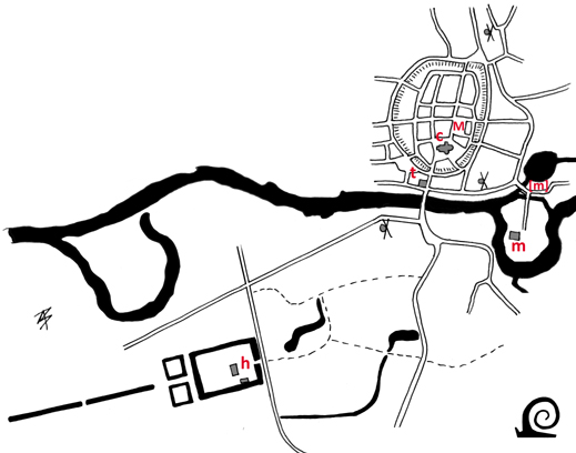
urban cores Obuda is the oldest. There was a roman settlement and military camp here from 29 AD called Aquincum. At the heart of Pest and further north near Margetsziget a small roman fort was built on the bank of the Danube.

Pest is first mentioned in 1148 as the trade city opposite the castle on Buda-Hill (Budavári Hégy). As is often the case the church freedom is located on the old roman fortress. A settlement grew along two parallel roads on the floodplain of the Danube. It is unclear when this settlement was fortified with walls. The first fortifications from the eleven hundreds were most likely a raised bank with a paling on top. Most walled fortifications were constructed from the 13th century onwards. The well known semicircular shape with a high wall and 4 large gates was probably constructed under King Mathias Corvinus in the 15th century. After the recapture of the city from the Ottoman Turks by the Habsburg Emperor in 1686 the city lay in ruins and had to be rebuilt and resettled. Reconstruction adhered to the older medieval layout.

In 1704 Pest received the charter of Imperial Free City of the Habsburg Emperor. The construction of the Invalid Hospital (now the City Hall) between 1725 and 1735 resulted in a break of the medieval walls to create a better connection to existing roads and the market fields beyond the walls. By 1730 the area within the old walls has been completely repopulated and filled in. This quickly lead to the development of suburban settlements beyond the walls. In an effort to guide the spatial development and regulate the supply of fitting residential areas new suburbs were designed encircling the walled city during the second half of the 18th century, much like what was done in Vienna and Munich.

Again along the Germanic model, these suburbs were named after royal patrons. In 1777 Térezváros (Theresiënstadt) was named for Queen Mary Therese who had visited the area in 1751. The Alsó-Külváros (Lower Suburb) was renamed Józsefváros (Josefstadt) in 1the same year to honour Emperor Joseph II. In 1790 the northern suburb is (re)named Lipótváros (Leopoldstadt) in honour of king Leopold II. In 1838 a large flood destroys large parts of this and the other suburbs and it is rebuilt on a grid layout. In 1792 the development of a new suburb started in the south. It was named in honour of King Francis I of Hungary as Ferencváros (Franzstadt)  In 1882 a section of Térezváros was renamed in honour of the popular Queen Elisabeth (Sisi) as Erzsébetváros (Elisabethstadt).  

By 1780 more people were living in the suburbs than within the old city. This development required better communications. There had been no bridge across the Danube, but in 1761 a barge bridge was constructed linking Pest and Buda. The first bridge constructed was the Széchenyi Lánchid (Chain Bridge) opened in 1849.

As part of the planned suburbs wide radial streets were laid out that ended at the old city gates. On the north side several squares were laid out along a wide street from 1812 onwards. Before large market fields for livestock and horses were located here. The poor connectivity between the old city and the suburbs created congestion and traffic problems, so a rethink along the lines of Hausmann with large boulevards was planned. The initiative came from count Gyula Andrássy, the then Prime-Minister, who proposed a new boulevard belt road and radial in 1870. This plan included a small boulevard ring (Kiskörút) that replaced the former city defences, a large boulevard ring (Nagykörút), a new radial (Sugárút) and two new bridges on either end of the large semicircular ring road.

In 1900 a very Hausmannian intervention was proposed, with a new boulevard running straight through the old city centre from the east station across a new bridge towards a new square on flat terrain between Castle Hhill and Gellért Hill. This would materialise as the Kossuth Lajos út and the Erzsébet híd (Elisabeth Bridge). The boulevard was angled such that it avoids the medieval church of Mathew. At the same time most buildings around this church were torn down. The old central square was thus greatly enlarged, but lacks a clear spatial definition.


The axial interventions superimposed on the historic core of Pest. The seminal structure was a roman fortress located underneath the central square and church freedom (A). The second urban core was centred around a former abbey - now a university (B). To the north of this walled city on the market field the Erszébet tér (E) and Vörösmarty tér (V) were laid out. The Bajcsy Zsilinszky út (1) was built as a wide thoroughfare along the edge of Lipótváros. In similar fashion the Rákóczi út (2) and Üllöi út (3) were constructed. The National Museum (M) of 1849 predates the ring boulevard that was built over the former city walls. This Kiskörút connects indirectly to the Széchenyi Lánchid (H1 - 1849), and directly to the Szabadság híd or Liberty Bridge (H3 - 1896). The central Erzsébet híd (H2 -1903) connects to the new central boulevard.

Budapest is still very much a twin city with the hills of Buda in the west and the flat city of Pest in the east. Of the 5 bridges connecting this "inner city" span the wide Danube, 4 are part of the historic ring boulevard structure impose on the expanding capital of Hungary in the 19th century. Nowadays the city centre has expanded beyond the old walled city, but also includes parts of the planned suburbs within the 1877 Nagykörút.


The spatial structure of Budapest is dominated by the physical landscape and the 19th-century interventions. The double semicircular boulevard belt roads are the most prominent feature.This structure is mainly located in Pest (P) and avoids the hilly terrain of Buda (B), Budavári (V) and Gellért Hill with the Citadel (C). The flat "Watercity" Víziváros (Vv) is also avoided.The old city of Pest is encircled by planned suburbs starting with Lipótváros in the north via Térezváros (T), Erzsébetváros (E) and Jószefváros (J) to Ferencváros (F) in the south. Two large urban spaces, Vörösmarty tér (1) and Erszébet tér (2), form a buffer between the grid suburb of "Leopoldcity" with its central garden square (3) and the old city. At the edge of this suburb the parliament building (4) was built. Andrassy út (A) with the Opera HOuse (6) forms the back bone of "Theresiacity" beyond the outer belt boulevard. It culminates in Hörök tére (Heroes Square - H) on the edge of the City Park (Városliget - VL). Both railway stations (north station - 5 and east station - 7) are located on the edge of the planned suburbs near an important junction of radial roads. There are no formal ensembles along the boulevards! The National Museum (8) and the Corvinus University (9) are located directly adjacent to the inner boulevard. The 5 bridges started with the central Széchenyi Lánchid (h1) and was followed by the Margit híd (h2 - 1876), Szabadság híd (h3), Erzsébet híd (h4) and finally the Petöfi híd (1933), thus completing the circuit.  

Monday, July 27, 2015

Examples of Saxon Borg-towns in Twenthe, Part 2


There are eight examples of Saxon Borg-tows in Twenthe, that all share similar spatial characteristics. Two of these never grew into a "proper town": Goor and Diepenheim. The other six - Oldenzaal, Rijssen, Ommen, Ootmarsum, Enschede and Delden - grew into small town that sometimes expanded considerably with the industrialisation of the late nineteenth century. Most however have remained small market towns often with an imposing castle or Havezate (Manor house) in close proximity. The firstfour examples have been discussed in Part 1, the other four will be discussed below.

Ommen
Near a ford on the Vecht river on a river dune a settlement grew. The name is probably derived from öne or une and means "place by the small river". On the edge of the higher ground a stronghold was constructed to protect the river crossing. The Bishop of Utrecht imposed a river toll on the Vecht. As a result the settlement near his manor grew. So it was decided to expand the settlement. To better facilitate this the bishop granted Ommen city rights in 1248. the settlement was expanded northwards in a regular fashion following the regular parcellation of the land. In 1382 Hugo van Verssen receives the manor of 't Laer of the bishop. Sometime in the previous century the bishop had moved his seat from the town to a new location south of the river. A country house on moated site with  a formal garden still stands here.


The planned town of Ommen sits on higher ground near an important river crossing. The town hall (t) is also located near the bridge. The church (c) stands close by with a market (M) laid out directly adjacent to the former stronghold or borg. On the river Vecht the oldest watermill [m] was replaced by another watermill (m).The manor house (h) of 't Laer is situated south of the river. 


Ootmarsum
Around 770 one of the earliest churches of Twenthe was built in on the compound of a local chief who also gave his name to Ootmarsum (the place name means: Homestead of Otmar). In 917 St. Radbod dies in Ootmarsum. The moated and fenced church freedom thus gains importance and a service settlement grows around it. In 1196 the Drenths plunder the village and burn it to the ground. Between 1200 and 1400 a new -enlarged- church is built.

In the thirteenth century several noblemen from Twenthe bequeath land to the Teutonic Knights. In 1262 an outpost of the central Bailiwick in Utrecht is founded in Ootmarsum. It is located on a moated site just outside the village. The choice for Ootmarsum was probably actively supported by the bishop as it made it easier to control this remote corner of his domain. On the moat a large watermill was built, with a second one further downstream. With the Teutonic Order in place the old stronghold is abandoned.

Around 1300 Ootmarsum receives its city charter from the bishop. So an outer moat is dug and earth banks are raised. The moat is fed by a channel from the nearby marsh called the Mos. A space behind the church is designated for markets, but proves to small so a new market is created within the town, resulting in two market places.


Ootmarsum is a lovely example of the iconic Borg-town pattern with the church (c) within the confines of the former borg and central in the town. Near the church a market (M) has been laid out with the town hall (t) directly on it near the church. A seccond market and church are located on the edges of the town. Directly outside of the towns defences a manor house (h) stands, here directly adjacent to the watermill (m).


Enschede
There are no written records of the early history of Enschede, although it is clear from archaeological finds that there was a borg or stronghold on higher ground between the Roombeek and Glanerbeek, two small rivers. The stronghold lay central to the Marches (Marken in Lower-Saxon) of Usselo, Esmarke, Driene, Lonneker and Twekkelo. The name Enschede also means on the border (the place where the separate Marches met). These marches fall under several overlords: the bishop of Utrecht, Werden Abby or the Maltese Knights of Bergsteinfurt.

The former stronghold of Esmarke lies at the heart of the historic city. Here a grain store, barn and stables were built to collect the tithes. Next to this a shield-shaped church freedom was marked out around which a settlement grew. In 1319 the bishop grants a town charter that includes the right to host markets, raise taxes and built a defensive wall. A moat is excavated and a paling raised on top of an embankment that encircles the existing settlement. The settlement was already surrounded by a fence before 1300 (as there is mention of two gates at that time). In 1325 the city receives full city rights as a court is installed and a weighing house and trade hall are built. In 1465 a second circular moat is completed. This moat is surrounded by a thorny hedge. The borg had been demolished by 1449 as it had lost its defensive function. In 1535 a local nobleman builds the Nye Borgh in the southern corner of the city. Around 1600 the defences are dismantled and the town sleeps until textile manufacturing and other industries create rapid growth after 1860.


In Enschede the oval shape is indicative of it being a Borg-town, but here the former defensive mount of a borg-keep is still visible behind the town hall (t). As an important town there are three churches (c) and two markets (M). The watermills were located at some distance in the Marches.


Delden
This place is first mentioned in 1036 when the bishop of Paderborn grants his manor or estate (praedium can mean both) of Theldene to the collegiate church of Busdorf. It is likely that soon after a chapel or small church was built on the edge of the estate. This church and the tithe was gifted by the bishop of Utrecht to the collegiate church of St Peter also in Utrecht in 1118. This means there was a manor or grange here that fell under the dominion of the bishop. In 1294 the collegiate sells its property on to the collegiate church of St Lebuin in Deventer. As the collegiate church of Busdorf sells its property in 1239, both are different entities. there is clearly a large landed estate called Delden that can be equated to Deldeneresch, a number of Marches on a fertile ridge of land and a stronghold  the edge of the ridge on an old road that must be located around the Church of St Blaise. Saint Blaise is the patron saint of Paderborn, making it likely that they are responsible for the foundation of the first church.

The stronghold with grange and church would have been surrounded by an earth bank or paling. To expand the grip on his dominion the Bishop of Utrecht grants special rights modelled after Oldenzaal on what he calls Nyedelden (New Delden) in 1333. Around the original compound a wide encircling moat is dug and an earth bank raised: with a paling on top and a thorny hedge at the foot of it. A new market place is laid out and on the landed estate (that had come in the possession of a fief of the bishop) a new grange was erected known as Erve Hofmeijer (Farmyard of the Sherriff). The new vassal was Herman of Twickelo who expanded his property House Eysinc into the caste Twickel that now stands in the former marsh at the foot of the fertile ridge.


The small circular town of Delden occupies an area far smaller than the neighbouring estate of Twinckel Castle (h). The oval moat and bank encircled a small Borg-town with a church (c) at the site of the former grange. The market (M) is located directly adjacent. The town hall (t) stand on the main thoroughfare.

Tuesday, July 21, 2015

Examples of Saxon Borg-towns in Twenthe, Part 1


There are eight examples of Saxon Borg-towns in Twenthe, that all share similar characteristics. Two of these never grew into a "proper town": Goor and Diepenheim. The other six - Oldenzaal, Rijssen, Ommen, Ootmarsum, Enschede and Delden - grew into small town that sometimes expanded considerably with the industrialisation of the late nineteenth century. Most however have remained small market towns often with an imposing castle or Havezate (Manor house) in close proximity.

Goor
On a stronghold near the marshland and moors surrounding the Regge river the seat of the Counts of Goor stood. They ruled the County of Twenthe on behalf of the Bishop of Utrecht an were important marshals. The counts lead the bishop's army on several occasion. The Borg also known as Huys te Gore was the official residence of the bishops in the county. As the location of the official residence the place was granted full city rights in 1263. So an earth bank was raised with wooden gates on  the 3 entrances to the Borg. The castle and the fledgeling town within the defences were completely destroyed by Gijsbrecht van Bronckhorst in 1348. It would never be rebuilt and the church (c) was relocated towards the watermill (m). The town hall (t) stood opposite the church. The settlement had no market square and developed beyond the moated site that served as a refuge in times of conflict.


The spatial pattern of Goor shows the former borg at some distance of the "new town" that grew around the watermill at the crossing of the river Regge. The place name "Goor" means marshland.


Diepenheim
The name Diepenheim also indicates the original landscape as it refers to a homestead (heim) on a deep canal or river (diep). On an artificial island in the Regge river, near a natural ford, a castle stood. In 1177 the castle on the moated site is destroyed and moved to a new site further west. In 1224 the manorial chapel was elevated to parish church. The Lord of the Manor promoted his settlement further by widening a street into a market and excavating a moat around this service settlement. This "market town" never received official city rights from the overlord (the Bishop of Utrecht) but served as a town nonetheless. It still sits as a small town surrounded by several country houses one of which is the successor to the old Huis te Diepenheim.


In Diepenheim the old stronghold is still visible as a more or less triangular section with the parish church (c) west of the town with its market (M). The new Manor house (h) is situated beyond the river on a moated site.


Oldenzaal
In the heart of this city lies an old freedom that is also the reason that a town and later a small city came into existence here. The clue lies in the name Oldenzaal which is Saxon for "The Old Hall" and refers to an enclosed Franconian manor where around 769 the travelling Monk Plechelm founded a church. In 954 the Bishop of Utrecht founds a collegiate chapter here and secures the old borg as a church freedom. In 1049 the settlement is granted the right to host a weakly (goods) market and 4 yearly  (cattle) markets. The wider town is then surrounded by a moat and a paling. Full city right are granted somewhere before 1240 and the town builds new defences; first an earth bank and later city walls with bastions and a double moat.   


Although basically a Borg-town Oldenzaal lacks the manor house and water mill in close proximity to the town. At the core stand the church of St Plechelm (c) and the Town hall (t) with 3 markets (M). This large number of markets combined with the presence of a hospital (H) indicated the status as a city.


Rijssen
This historic Borg-town has been changed beyond recognition by post-war interventions in the urban fabric. Originally a stronghold of the Counts of Dale Rijssen was granted city rights in 1243 by the bishop of Utrecht to balance the power in Twenthe  as a result of a disagreement with the Count in Goor. Immediately after the charter, with the city rights modelled on the Deventer-charter, was passed work starts in raising a high earth bank with paling and excavating a moat. The site of the town was strategically placed along an old thoroughfare on the transition of low-lying marsh (mors in Saxon) and higher ground. The town is located at some distance from the Regge river. In 1350 the town joins the Hanseatic League. Its status is also supported by the existence of a Richterambt (a Sheriff Court). Before 1334 the manor house is moved to a new site east of the town.

The residents (burgers) of the cities of Deventer, Hasselt, Kampen and Zwolle are decreed free travel through Twenthe by Bishop Johan van Diest in 1328. In his decree he also makes special mention of the Stalle to Risnen. Rijssen is thus defined as a station on a route through the County. For this an older site was used that lay just beyond the oldest borg-enclosure. The moated site was drawn into the 13th-century fortifications and thus doubly protected. Thus the Knightly Manor of Bevervoorde (Litterally Beaver ford) became an instalment for travellers across the region.


The pattern of Rijssen shows the iconic rounded shape of a Borg-town with a church (c) at the centre, with the town hall (t) opposite on the edge of the former stronghold. The new manor house (h) is situated outside of the defences. The watermill (m) is located on the outer moat (on the original Risse or watercourse that gave Rijssen its name). The market (M) is again a widened street, here just beyond the outer moat, the Havezate Bevervoorde (b) is located within creating a distinctive pattern that indicates a planned but never executed extension on the west side of the town.

Monday, July 13, 2015

Saxon Borg-towns of Twenthe


The area of Twente (Twenthe in English) is located in the east of the Netherlands. The area is part of the Lower-Saxon section of the country comprising of De Achterhoek (literally: the rear corner), Overissel (Overijssel in Dutch) and Drenthe. Historically Overissel and Drenthe formed the Oversticht, the land held by the Prince-Bishop of Utrecht as a direct fief of the Holy Roman Emperor. The Shire of Twenthe formed part of the Lordship Overissel and was first mentioned in 797. The name is said to mean "the two lands", which fits the historical situation as the shire was once divided in an Upper-Twenthe and a Lower-Twenthe. Twente is still known in the Netherlands as De Graafschap an name that literally means The County. A fief known as Graaf (Count) resided in Goor and ruled on behalf of the Bishop of Utrecht.

The fiefs of the Bishop were obligated to provide military support. The noblemen that amassed the bishop's army were also known as Borgmannen. This name reflects their status as Lord of the Manor. A fortified manor house or a moated castle keep was the preferred residence. The name borg is derived from borgen, which means to keep safe in Saxon and is thus akin to the Frankonian burcht a name mostly used for a castle. Borg and burcht are cognates of borough and burgh.

The land consisted mainly of vast woodland and waterlogged moorlands. The soil type is mixed with peat, sand, clay and loam often found intermingled or in close proximity. From about 1000 onwards more land is taken into cultivation creating large communal fields of arable land known as 'essen'. Besides these the area was littered with small individual landholdings known as 'kampen'. Villages and hamlets were always located near the arable fields.

The local strongholds were always located near a river(crossing). It is sometimes unclear if the borg preceded the crossing or a ford on an ancient trail preceded the castle. There were several such strongholds, all located near an important thoroughfare or a river crossing that all have a similar shape. Basically the stronghold consisted of a main building within a paling surrounded by a moat. Within the moat a chapel and store were located. The foundation of such a stronghold invariably lead to the clearing of existing woodland for farmland. These fields took the shape of wide strips of arable land. More often than not the lord would also secure the right to mill grain and build a watermill near the stronghold.

As the area under cultivation grew steadily the means of the local rulers grew accordingly. The existence of tactically placed strongholds meant that people choose to live nearby in a service settlement. As trade expanded the local lord and overlord wanted to secure their take of the gains. This was done by imposing tolls and later by stimulating economic activity. On of the ways to stimulate local production was the foundation of a monastery or convent. This invariably lead to large-scale clearing first of woodland and later of marshland and bog.

Another way of stimulating local productivity was to grant special rights to a settlement, the so-called city rights or charters. Local lords also liked to favour their service settlement and sought to gain from developing it into a small city. This often lead to planned spatial interventions to accommodate this new urban function by laying out a market field and securing the settlement. None of these Borg-towns had a city wall. They are characterised by an oval or circular outline with an outer moat and a paling on top of a bank. At the entrances (mostly 3) wooden gates were built to signify the different status of the settlement and residents within. The residence of the local lord still stood within the town, but no longer on a moated site. The increase in population often also meant an expansion of the industrial capacity by building  anew (wind)mill or expanding the existing watermill.

The third possible phase in the development of a Saxon Borg-town involved the lord leaving the confines of the town and erecting a new manor house along a main road or on the edge of uncultivated land. This move signified the independence of the town. On the former stronghold the small church that had evolved from the manorial chapel was expanded and a city hall was built nearby or on the market square. In this phase the streets are paved and the paling is replaced by a high earth bank.


The three phases in the development of a Saxon Borg-town. [1] First a stronghold (1) is built consisting of a moated site with a residence (a) and a chapel (b) near a river (3). Next to this stronghold new fields (2) are cleared for cultivation. Near a river crossing a watermill (c) is built. [2] In the next phase a town is created within a paling and a moat (4). The chapel is expanded to a parish church (d) and the watermill is expanded with a second mill (e). [3] In the third phase the settlement becomes a true town within a high earth bank and a wide moat (5). The church is expanded further (f) and a town hall (g) is built. A new manor house (h) is erected outside of the town. The market square (i) is now a formal space within the layout.

Although the pattern is the same for all Saxon Borg-towns, each has known a singular development resulting in different layouts en spatial ensembles. Goor, historically the main Borg-residence, never grew into a full town for instance. The rounded shape of a Borg-town should not be confused with the circular layout of a Terp-village that are found in the northern Frisian section of the Netherlands. There the circular shape is the result of the planned raising of a flood mount.