Wednesday, February 21, 2018

The urban landscape: Situationalism, or designing with the context


Call it idealism, but I like to be a person who stands for something. In my work I feel all I do should at least not lead to more ugliness, but favourably to more beauty. This takes a well-understood notion of what beauty is within the urban landscape and were the strength of intervention lies.

I did my professional training in a time when postmodernism was more or less the norm for what was included in magazines and books and New Urbanism was slowly taking root in Europe. Despite the focus on postmodern design, planning was taught from a modernist tradition in which functionality was the basis for every plan. It was pointed out to me several times that a good designer should have a signature, a certain style of his/her own. That would be the expression of what that person stands for as a professional. Often I saw this personal style being translate into expressly shaped collages of interventions, that together formed an almost graphic composition in two dimensions. I found that problematic; I’d rather not be confined by a distinct style, as it can quickly become a trick.


A strong intervention is the Erasmus Bridge across the Meuse in Rotterdam. This asymmetrical design by Ben van Berkel from 1996 was nick-named The Swan because of the shape with the kinked pylon. Such an intervention creates place and makes the most of the wide expanse of water that mirrors the high-rises of the city.

Interventions are often only judged to be successful when they are striking. Notwithstanding some marvellous examples, these interventions are often stand-alone and no real addition to their context. For me a good design or a successful spatial intervention is, if anything, inconspicuous. By inconspicuous I mean that the new situation comes across as self-evident. I don’t like it when a place looks overly designed or needs explanation to reveal the designers meaning. Don’t get me wrong, I’m not advocating disguising change behind a veneer of constancy by dolling up a reassuring decor for everyday life to run its course. No, the character of the urban landscape it too interwoven with its use and users to be a mere stage set.

I approach every intervention from the context of the site. Now most colleagues will argue that most of them do this, as they have been trained to make a good analysis of underlying abiotics, visible patterns, spatial characteristics and current use.  Adding the specific history of a site and for most planning professionals the first chapter of the explanatory notes is solid and finished. Whether they all come to the right conclusions is a different matter altogether.

I think to be designing from the place. The question should be again and again: “what is relevant here?” Is geology relevant, or should ground water be considered? Or is perhaps the history of the place or the present flora most relevant? It remains difficult to weigh up the relevancy, especially if one works from a fixed format. I therefore try to take the open approach based on the situation and in part rely on past experiences.


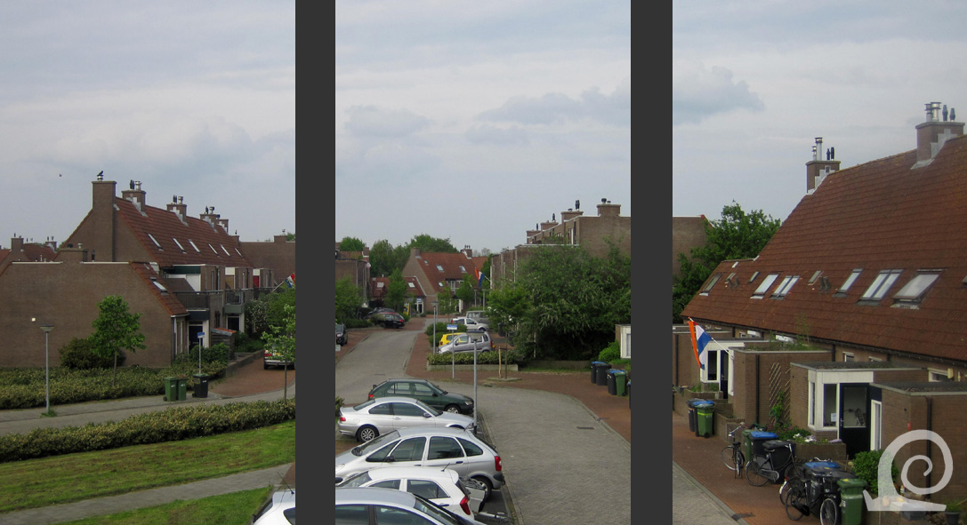
Situationalism at work: on the left a row of new-built houses replacing older housing in garden village De Zanding in Ede, not far from Tuindorp Vooruit. The design of these houses fits well with the aesthetic of a garden village. Another successful intervention are these new garden sheds (right) in Tuinwijk Palliter in Lierre that are covered in orange clay tiles to resemble the roofs of the listed buildings in this garden village.

As a situational designer, one tries to bring out the best of any given place within the limitations of the desired functional or spatial change(s). Contextual design can also mean that something unique is added to a place. That can even be an intervention made before in another location, everyone has their own references. Situational design isn’t the same as limiting yourself to what is already there! What is important is that design elements aren’t simply copied or introduced without any regard for context or function. When suddenly a small square in a drab new town is laid out afresh as if it were a Tuscan village square complete with pollarded plane trees, olive trees, lavender in tubs and areas of soft yellow gravel, you can bet that counsellors and /or civil servants have come back inspired from a study trip or holiday.

“I’d like that too” is a very dangerous sentiment anyway. It has caused many uninspired, similar developments of small industrial and trading estates along B-roads and motorway junctions. It is too awful for words how a policy of compact development and concentrated expansion to preserve space and the landscape has lead to uniformity of small developments on the edge of pre-existing urbanised areas and larger developments in often conspicuous places along infrastructure. Often the only reason for building at a certain site is that it wouldn’t be built somewhere else. Such poverty!


Lelystad is a new town on new land in the North Flevopolder. There was nothing to base the design on so designers and planners had free reign to create according to their purest principles. The result is overall very disappointing. The urban space is never pleasant or cohesive even though the quality control of the architecture was strong and there was much attention paid to planning the streetscape.

It can’t be expected that any development can be dumped in any given location and be bought off by a spruced up bridle path, a few rows of oak trees or a small field planted with fruit trees. Why do (landscape) planners lend themselves to this? It should be them especially that adjust unfavourable initiatives and bad design to beautiful places by coming up with design improvements and suggestions for better interventions. The reoccurring mantra that developments need to be integrated into the landscape deserves an honest answer from the specialist: a well-integrated urban landscape requires more space, spatial integration isn’t a tool for reducing the size of developments. A truly spatial solution requires courage to advice a fitting strategy and a good idea to convince the stakeholders.

Functional integration can however save space. This makes the tendency in planners and politicians alike -presumably to create legibility and legal clarity- to situate monofunctional areas side by side all the more objectionable. I immediately think of those awful narrow strips of weeds along brooks and woodland, that are supposed to create an ecological corridor between designated nature reserves, themselves often little more than a weedy field with a few trees and a freshly excavated pond for newts. To my mind a small river valley has been well appointed when there is room for wild animals and plants to flourish and coexist with sixty something ramblers in wax coats and methane burping rare breed cows. The focus should then shift from preservation of rare species at the edge of their range towards common, but often declining, species. Seeking smart combinations of functions will result in much more future proof usage then monofunctional segregation. This also is a situational approach.


New Urbanism can have a situationalist vein as shown here in the Inverdan Project in Zaandam.  A former canal that was filled in was re-excavated as the central motif in a revamped shopping street. New additions replicate vernacular architecture with the typical wood planked weather boarding in green with white trims (on the left a new kiosk). The canal was given new bridges (middle) which effectively partition the space and create a sense of place. The large office blocks behind the station (right) are much less inspired although they employ the vernacular colour scheme and shapes. I think they are a mistake of scale.

That situationalism would be synonymous with conservative or even anti-change is a misconception. The only stable characteristic of the urban landscape is that it is everchanging. The result of these successive changes and interventions is the backdrop of all our lives. Our urban environment has developed into a pattern-card of the successive ideas on urban design, architecture and planning. The same is true for green areas, whether these are public gardens, parks or green belt. The resulting legibility of the spatial and temporal development is itself characteristic for that area and often quite charming. Especially for those concerned with the study and analysis of spatial development those coherent characteristics of architecture, street plan and greenery are truly a blessing. The New Towns are excellent examples of the changing trends and ideas from their inception until the present all neatly organised in separate areas. That characteristic alone is worth treasuring.

That said, many -myself included- feel that something vital is missing from many of these planned New Towns. The issue is not the fact that they were planned to be built from scratch (the same is true of the much-admired Amsterdam Canal Belt), or the fact that the architecture is the portrait of an era (this is also true of the 1920s-1930s architecture). The main difference lies in the lack of coherent and legible spatial ensembles. This is especially apparent in those streets with 1930s retro-architecture that lack the Unwinesque design features. The houses are little more than a facsimile of a copy-paste exterior deemed desirable that disguise modern constructions in a standard commercial parcelling plan. Despite all this desperate desire for old-fashioned streets, they never result in an urban space that is coherent or pleasant because the plans weren’t conceived with designing with ensembles in mind. 


More New Urbanism in this large Outlet Mall in Lelystad. Bataviastad was conceived as an attractive tourist attraction with architecture recalling old fishing towns on this new land, which makes it quasi-authentic, disingenuous and not situationalist at all. This stand-alone development on the edge of the city was named after the replica ship Batavia moored nearby. It was opened in 2001 and for all its flaws it was designed as an ensemble which results in a personable place with spaces that work.

Designing with ensembles is at the core of situational design. A historic reference can prove helpful, especially if this generates surplus value for the initiators of the planed development. It is never a good idea, however, to copy certain solutions regardless of the context and strew the urban landscape with the same garden squares, waterside gabled houses and fake farmsteads everywhere. Understanding the context creates uniqueness and personality. From a situational approach come obvious interventions, that will be inconspicuous, but especially characterised by a high degree of identifiability and intrinsic value. That’s what I stand for! 

Wednesday, February 14, 2018

Change in the city: building for the future


The urban landscape is in a constant state of flux; there is always someone building somewhere in the city. In fact the only stable attribute of the urban landscape is its changeability. Most of the development will centre around housing as it is the most important form of use in our urbanised environment. Other use like commercial industrial, leisure, transport, water and nature are seldom fixed.


Building something new also means bringing down the old: demolition reveals itself in skips on the roadside filled with debris and waste (left). Building works also mean road closures (middle) and sites being cordoned of or secured by building fences. New buildings always start with laying new foundations (right) which have to be excavated first.


Between the boards the foundations are poured. The holes for future pipes are included and some of the pipes have been put in place (left). The houses can then be built. In this social housing project the houses will be constructed using pre-cast concrete panels which are hoisted into place by a building crane (middle). An alternative is to erect the walls using an inner wall of breeze blocks and an outer wall of bricks with insulation in between (right).


Construction a building from blocks means the builder can be more flexible. Windows are placed in the holes left in the wall before the insulation and outer skin are put on (left). Here re-used bricks are used to construct the outer skin of the building (middle) to make sure it is in keeping with surrounding buildings. The face of the building changes completely once the brick walls are maid (right).


When I was in London I visited the redevelopment area behind St Pancras. Here building takes place on a large scale, redeveloping the railway lands into a modern new housing quarter. Some buildings have been finished, others are being erected. The area is a building site that has to be liveable so covered walkways (middle) have been put in place, a park has been planted (left) and building on the central square have been replaced by a lovely reflector artwork wall (right). 

Friday, February 9, 2018

The urban landscape: towards the fractured approach

When I was a student some of my fellow students declared city planning obsolete and urban design for dead; as they saw it there would only be interventions as market forces determined the future development of the city. Others were very vocal adepts of New Urbanism, especially after the Congress for the New Urbanism was started in 1993. In contrast my teachers at university were in the main functionalists, with some admiring and advocating the shapeliness of post-modern planning. I strongly feel that any spatial intervention or design should focus on the context and resolving the given problem(s) whilst at the same time creating an attractive environment. Many look down on such a practical approach, but I go about everyday practical planning unashamedly!

As the years have progressed since I graduated, I’ve seen the city around me change. Yes many of the developments are redevelopments of older neighbourhoods, former industrial sites, empty office blocks and former commercial sites (shops, market halls etcetera), but there have also been large-scale building projects developing fields. The era of large-scale developments (for housing and business) is almost at an end it seems. So the new development areas comprising of several new housing estates, arranged as neighbourhoods around a functional centre with a commercial estate on the side -known as Vinex in the Netherlands-, will be the last of their kind. Although… there is talk of expanding certain villages around fast growing urban areas, like The Hague, Amsterdam, Groningen, Tilburg, Breda and Eindhoven.

House building on a large scale on a unified plan was made possible in the Netherlands by the 1901 Housing Act, which sought to improve housing standards and provide affordable housing for the working classes. The first of these planned estates follow German examples of Sitte-esque urban design on artistic principles and English garden city examples, or they were built along rational and functional principles (the Low Countries were important in early modernism). Planned housing started rather small scale before WW1 and really took off after 1920 with a high point in the 1930. These neighbourhoods are well appreciated and were emulated after 1990 in a New Urbanism / Postmodern effort to create place.


Two examples of 1920 urban design. On the left the Sitte-esque neighbourhood of Sonsbeek-Noord in Arnhem which also resembles a garden village (the number of houses per acre is to high to be a true garden village). In contrast the New Objectivity approach by J.P. Oud in Mathenesse (right) makes the most of the triangular plot whilst still giving all residents a garden and a house with ample light and fresh air.

A phenomenon typical of the Netherlands is the way that housing was planned after 1945. Modernist thinking had taken over planning as the need for more housing could be more easily met via standardisation and repetition. Also Pillarisation (Verzuiling) meant that society was segregated along politico-denominational lines so planning had to allocate space for each group. This lead to the so-called Wijkgedachte (urban district approach) which centred around the decentralisation of the city. The urban district approach was first proposed in the book ‘De stad der toekomst, de toekomst der stad’ (The city of the future, the future of the city) by building engineers Bos and Van Tijen. The CIAM delegation in Rotterdam was also involved in the development and realisation of this urban design theory. Lotte Stam-Beese made this approach famous with her designs for Pendrecht and Hoogvliet in Rotterdam. Also in Rotterdam C.M. van der Stadt pioneered the Stempelstructuur (Stamp Structure), a repeated ensemble of housing similar to using a stamping block in printing wall paper.


Stamp Structure housing estates are everywhere in the Netherlands. Here an example from Eindhoven-Eckart. Several ensembles of row housing are repeated forming distinct neighbourhoods around the rational main infrastructure. The urban district centre with shops is located on the edge near the park along the Oude Gracht (Old Canal), a partially silted up arm of the Dommel river. A similar structure of repeated unit can be seen on the other side of the thoroughfare. The housing in the righthand corner is from the 1980s and consists of more expensive housing.

The theoretical foundations of the urban district approach was thoroughly modernist and revolved around functional and practical separation on various levels. The lives of people could be hierarchically classed around several social groups with different needs on different levels. The city could be divided into social units, based on an idea(l) of the integrated village, of about 20.000 people: the urban district unit. Each urban district would have a district centre with sports facilities, shops and a secondary school. Each urban district would be divided into neighbourhoods. This made it possible to allocate specific neighbourhoods to a specific social pillar. In this approach it is very important that the city is legible as a collection of spatial unit. These are also physically separated in the urban designs up to the 1980s when the anti-urban approach of Postmodernism starts to dominate, resulting in so-called Bloemkoolwijken (Cauliflower Estates) with little to no spatial definition. And they are therefore difficult to navigate. The organic design principles advocated in the 1980s were a reaction on the modernist estates that were seen as boring, bleak and not on a human scale.


The district approach in action in Veldhoven. The old villages (in yellow) of Zonderwijk (W), Veldhoven (V), Meerveldhoven (M) and Zeelst (Z) were expanded by building several urban districts in the fields (in orange). These are all physically separated by greenery and infrastructure. Each has its own district centre (in purple), with a new city centre (in red) built where the old villages meet the new developments.

In the 1980s financial difficulties force local government to surrender urban development to market forces and limit its involvement to legislative embedding, supervision and quality control. To secure developers don’t simply build the houses they can make the most profit from central government creates incentives to aid people to buy a house via a direct subsidy and also prescribes minimal numbers of social housing (to be realised by or for housing associations). The focus in public housing shifts towards home ownership and the privatisation of social housing is started. At the same time old neighbourhoods with social problems and often high crime rates are earmarked for redevelopment. This is done by replacing large amounts of social and affordable housing by more expensive middle class housing and even high-end apartments. Thus the socio-economic problem neighbourhood is resolved on paper, but the people are simply moved on to another area.

These redevelopments and even urban expansion in the 1980s and 90s is often piecemeal and in trances. A (re)development is portioned with distinct areas set aside for different developers. Each hires a different architect who is then instructed to create a distinct design (each developer want to be visibly different for marketing purposes). This creates an extremely fractured urban landscape of incidental design Sometimes large commercial developers force local government into developing an area as they own all the land in an area indicated on the development plan as earmarked for future development. Some even manage to influence political decisions on where to locate urban expansion based on their land positions. The city as a collection of architectural incidents is -unsuccessfully- combatted in planning by using themes, urban fields and geometric shapes and patterns.


The pinnacle of postmodern urban design must be Kattenbroek in Amersfoort. This large estate of mostly housing (4600 in total) and a small commercial estate was realised between the village of Hoogland and the motorway to Amsterdam. The design comprises of 5 elements translated into geometric shapes and architectural expression: The Ring, The Avenue of Mansions, The Hidden Zone, The Mask and The Creek. These 5 design elements are connected to 5 housing themes (The Closed City, The Fortress, The Farm Room, The Bridge House and The Winter Garden), as well as 5 landscape themes (Water, Pond, Wood, Field and Moor) and 5 urban morphologies (Avenue, Belt Road, Square, Alley and Street). The design is especially striking seen from above, but at street level shows itself to be little more than a collage of fashionable architecture in contrasting groupings.

For all the themes used and tightly controlled appearance of the housing built, the urban design is often little more than a narrative connecting the various separate components aimed at easy translation into legally binding land use maps. The fractured approach has now become the norm. The city of Eindhoven even presents itself with the motto ‘Scherven In het Groen’ (Shards in Greenery), although this is the result of the modernist planning doctrine with urban districts. The abandonment of planning with ensembles has lead to an urban landscape composed of fragments, that in the best cases have a great internal spatial working through the use of functional, spatial or architectural ensembles. On the larger scale the themed architecture cant hide the underlying lack of ideas. Many people consider these areas as non-places, as new housing estates could be anywhere and all look the same despite the great variation in often colourful architecture. As a reaction some planners and designers are revisiting designing with ensembles in an effort to consciously create an urban landscape that is legible for its residents and visitors alike.


The town of Leusden is a rather extreme example of a fractured urban entity comprised mostly of incidental urban interventions. This suburb of Amersfoort was never officially designated as such -as Amersfoort itself was seen as an overflow city for both Amsterdam and Utrecht. The result was a local authority being lead by private developers who saw opportunities for house building. The regular pattern of the polderland around the old village core (L) was incrementally developed; each new addition was given its own pattern, its own architectural expression and its own boundary within a framework of infrastructure.