Friday, May 31, 2013

Factory village: Batapolis in Best


In 1894 Tomáš and Antonin Baťa founded the Shoe factory T. & A. Baťa in their native town of Zlín in Moravia, presently in the Czech Republic. The company sought to implement industrial methods of shoe production and technical improvements such as the first cloth made shoe Batovka, first produced mechanically in 1897. Tomáš Baťa took inspiration from the  Ford factory assembly line set-up with standardized components. The whole production process and sales were kept under the companies control. They even produced their own rubber for the soles on site.

As a result of the rational and all encompassing Bata-concept of a factory with workers colony the small provincial town of Zlín grew into a large industrial city. The architects Kotara and Gahura pioneered an urban model they had called Batapolis. In the centre the factory was situated. The factory grounds were laid out according to a grid pattern. That way operating the railway was less cumbersome, the production process could be organized linearly and the factory buildings could be better positioned to have maximum daylight flood through the windows of the production halls. Around the factory the houses were erected. All were semi-detached dwellings, with free standing houses for the higher echelons. The houses were loosely grouped and had large gardens. Within the Batapolis model, families were housed in houses; apartments were designated to single workmen.

From the 1920s the firm expands within Europe. They open their first Bata store in the Netherlands in 1922. To circumvent customs tariffs Bata decides to build several factories all over Europe to produce for the local market. They didn't just build factories but also villages for the workers. At the end of 1933  a new factory was built south of the village of Best in the Netherlands. This factory is an exact copy of the mother factory in Zlín. At this time Bata exploited 28 shoe stores in the country. Many of these sold shoes and also had a workshop for repairs. The site in Best was chosen because of its proximity to a main train line (Eindhoven - Tilburg), the shipping canal (Wilhelmina Kanaal) and the low land values. The site was rather isolated and consisted of former heathland. This isolated location was ideal for creating a independent Batapolis. The factory produced shoes for women, men and children as well as sport shoes.

The regional plan De Meierij (literally: the bailiwick) drafted by the provincial planning department had not reckoned with a large factory site in the middle of the heath. Bata was allowed to build there, because securing employment was important. Planner J.M. de Cassares was in charge of drafting plans for the expansions of villages within the Meierij-region. His rational approach, modern stance on urban design and economical attitude concurred with the dynamic attitude towards the industrialization of the region held by the Bata company. Anonin Vítek had drawn up the initial plans. These plans were however dismissed by the planning inspector at the time called Bolsius, who advocated a traditionalist approach based on catholic values, preservation of the local appearance and the idea (or more to the point: ideal) of a local esthetic. 


The 1938 plan* by De Cassares for the new Batapolis (Bata City) in Best tries to marry rational land use and a favourable positioning to the sun with a garden city based street plan. This mathematical street plan owes -like most garden city layouts- to the then current trends in garden design.

Although the factory layout was based on a grid, as well as the first two rows of semi-detached houses Bolsius won in the end and a garden city esthetic was introduced. De Cassares translated this in his 1938 plan for Batapolis Best into a thoroughly modern (and rather emblematic) plan consisting of a main axis that formed the spine of a circular road intersected by roads ending in a close at both ends. Along these streets long rows of flat roofed semi-detached houses were envisaged. Around a central square that followed the old grid shops were drawn. Just below the pivot point of the factory grid and the tapering central parkway a church was imagined. Sadly only the northern most part of Batapolis would be built in Best. After 1945 housing for the workers was no longer provided by the Bata company but by a building society that developed Wilhelminadorp north of the Wilhelmina Canal. This location between the factory and the existing village of Best was deemed better suited for housing than the isolated Batapolis site. Thus Bata City never came to be. Now we find Batadorp (Bata Village) here in its stead. 


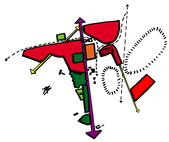
Here the original grid is superimposed on the never realized plan for Batapolis. A strip of green public garden separated the factory site from the housing. This is still the case today. Around the edges there was space for sporting grounds, a park or a farm. 


* the plan has been drawn based on a reproduction of the original land use plan and expanded from this.

Sunday, May 26, 2013

Mining colonies: Flemish vernacular style, Beringen-Mijn


A focus on vernacular architecture is one of the pillars that supported the garden city esthetic as advocated by Raymond Unwin. He in turn was heavily influenced by German and Austrian sources that tried to define and redefine indigenous design features in buildings. If the aim was to provide a new type of living environment that married city and country the typology had to be distilled out of existing examples of both urban and rural architecture.  As vernacular architecture reflects local traditions it was viewed to be the perfect expression of the built environment that aimed to house both former urbanites and new arrivals from the countryside. The focus on a vernacular architecture was both esthetic and social in nature.

In Beringen-Mijn a mining colony was developed to house miners and other personnel. Most miners came from an impoverished rural background. It was deemed fit to house them in structures reflecting the Flemish building vernacular. Some of the buildings though have a very visible Walloon influence with buildings (made to look like they are) constructed as half-timbered houses with an infill of either plaster or brick. This makes sense when one considers that mining was initiated, directed and financed by French speaking Belgians.


The Mulhouse Quadrangles (1907-08) were the first permanent houses to be built north of the colliery. Six were built with concrete blocks that were manufactured by the mine company. The buildings were made to look like they had been built in stone. The small side extensions have been greatly extended over the years, resulting in a continuous row of rather low houses between a street and a narrow lane.


The Laan op Vurten (Vurten Avenue) is an old thoroughfare that has been incorporated into the mining colony. The large houses (1910) were designed in a simple Walloon style with projecting eaves and brick facades subdivided by bands of natural stone that accentuate the windows and thus every storey of the house. A few houses are built in a Flemish vernacular with stepped and pointed gables and non-projecting eaves.


The Walloon vernacular is present in both workmen's housing as well as the villas for the white collar personnel. Although some people believe the architecture to be based on English garden city examples the architectural expression is modeled on examples of vernacular buildings in Wallonia. The projecting eaves, use of banding above the windows and flat chimneys are testament to this.


Everywhere in the mining colony the past is visible. The old railway still runs around the first garden village (Cité-West). Other remnants of the mining history such as this water tower can be seen from within the mijn-cité.


 The Cité-Oost (1920-'24) was laid out along winding streets with a lot of variation in the architecture. Because of the reoccurring use of the same materials and the same colours the garden village does feel like a whole.


In the Cité-Oost two closes were laid out. They are used as playing fields and not as a green around which houses are built. Thus one of the most recognizable morphologic elements of a garden city was functionally transformed in this mining colony.


The enormous church of Saint Theodardus (1939-'43) named after the nineteenth bishop of Maastricht. It is built in a neo-byzantine style. The primary school (1927) that sits at the heart of the Cité-Oost is a large brick building built around two central courts.


The football stadium (1924-'25) now sits empty. It was built as an ensemble with two short terraces on each side flanking the entrance.


The Stadionlaan connects the football stadium with the Beverlosesteenweg. The street is lined with semi-detached houses (1925) in a Flemish vernacular style.


The Kioskplein is dominated by the Casino (left) on the far end of the ensemble and the bandstand in a rustic style (right) in the middle of the public garden. Both the community hall (Casino) and the bandstand (muziekkiosk) are built in an eclectic style mixing both Walloon and Alpine architecture.


A view of the large houses (1927) for middle management that sit around the beautiful Kioskplein. Seen here from the public garden the Flemish vernacular style in which these houses were built is clearly visible. A lot of attention had been paid to the gables the windows and the window shutters on the ground floor. The ensemble is protected as a heritage site.


The Eeuwfeestplein (Centenary Square) consists of a tapering public garden with buildings on either side and a Hotel (a lodgings for single male workers) at its end. The whole (1929) was designed as an ensemble and is protected as a heritage site.


The Gouden Jubileum Plein is not a square like the name suggests but a large diamond shaped public garden with widely spaced houses (1946) around it in a rather formal arrangement. The brick houses are all in a (simplified) Flemish vernacular style.

Thursday, May 23, 2013

Mining colonies: Cité-West, Beringen-Mijn


The mining colony Cité-West is situated west of the Koolmijnlaan, the new main road linking Beverlo and Beringen that was constructed when the mine was founded on the heath in 1906. The area is now best known as Tuinwijk Koersel. Sometimes the name Kleine Heide is used. Development of the Cité-West started along the Tennisstraat. This road is an extension of the Ulfortstraat that once linked the hamlet of Ulfort to the Beverlosesteenweg. Here and on the Krommestraat short rows of quadruple terraced houses (vierwoonsten) and some semidetached houses (dubbelwoonsten) were built after 1923 according to designs made in 1920 by the architect A. Huybrighs who was also responsible for the Cité-Oost. The Tennisstraat takes its name from the tennis club for colliery personnel that is still located along this street. Parallel to this small first development the Eeuwfeestplein (literally: Centenary Square) was built. The name however suggests completion around 1929-'30 (as 1930 was the centenary of the independent Belgian state).

Between the Tennisstraat and the Koolmijnlaan sporting grounds were made. A small football stadium with wooden stands was completed in 1925. Fronting the main road four identical rows of terraced houses with four dwellings each were built. These short terraces also date to about the same period. The Stadionlaan (literally: Stadium Avenue) connects these sporting grounds to the Beverlosesteenweg. On this road comparatively large semidetached houses were built. These houses will probably also date from around 1924-'25. Between the Stadionlaan and the Eeuwfeestplein a large Hotel (lodgings) was built. The tapering green with houses on either side was designed around this large building.

South of this green a similar setup was chosen for the Kioskplein. Completed in 1927 these semidetached houses for middle management are situated around a public garden with a bandstand (kiosk) in the middle. The houses are built in an elaborate vernacular Flemish style in brick with stepped and bell-shaped gables and adorned with two-toned wooden shutters on the ground floor. In 1929 a large festival hall called the Casino was built on the far end of the Kioskplein.

Via the Kioskplein the Cité-West  is connected to a 20 acre park. Within these beautifully landscaped grounds the villa of the director stood.  The villa was completed in 1912 and was built in an eclectic Walloon style. An ornate wall still separates this once private park from the Koolmijnlaan. The building was known to the miners as 't Kasteeltje (the little castle). In 1936 the building was extended on the north side by the addition of a winter garden and veranda. Sadly the villa was burnt down by vandals in 1979 and now sits ruined at the heart of the park that has been opened to the public.

Directly south of the directors private park large villa's were built to house engineers and upper management. Work started in 1912 with the first villa's and continued during the 1920s. The result is a long ribbon of houses in an eclectic style facing towards the Koolmijnlaan directly opposite the colliery. Behind this ribbon of villas the tennis club was located along the Tennisstraat. Behind the directors park a site was bought to build a hospital. The building is now converted into a care home for the elderly. Directly next to the hospital a villa was built for the hospitals first physician. Further south along the Hospitaalstraat some large houses for doctors were erected.

Extending westwards from the Stadionlaan the Cité-West was enlarged west of the Beverlosesteenweeg in 1946 around the Gouden Jubileumplein (literally: Golden Jubilee Square). The plans were again drawn up by the architect A. Huybrighs. Planning for this part of the mining colony had already started in the 1930s but the economic crisis halted further development. The buildings are variations on previously built types albeit somewhat simplified. In 1963 a few semidetached houses were added on the far end. These simple houses would be the last to be built under the auspices of the mine. In 1989 the mine would close and the area directly next to the Cité-West was quickly filled with detached houses of little architectural quality and vision.


The Cité-West was gradually developed over decades according to plans made in the 1920s (area between Koolmijnlaan and Beverlosesteenweg) and in the 1930s (Gouden Jubileumplein).

Unlike the neigbouring mining colony Cité-Oost the pre-existing thoroughfare called Beverlosesteenweg (in yellow) isn't picked up in the design. Instead the Tennisstraat (T) an elongation of an old road is used as the central road. The second important line is the Havenlaan (H) itself another elongation of another old road. Lastly the Stadionlaan (SL) that leads to the Stadium (S) and football fields (1) forms the axis of the expanded garden village setup around the Gouden Jubileumplein (3). The tapering form of the Eeuwfeestplein (2) stems from the limitation of a large villa (V) in a private park and a parallel road. Part of this road is still the western edge of the Kioskplein (4). The bandstand (K) is the termination point of a side axis connecting it to the hospital chapel (Ziekenhuis - Z). Parallel to this line the house of the first physician (Dr) was situated on the main axis T. The Casino (C) is aligned with this axis and the main axis T. Between this main axis T and the Koolmijnlaan (KL) the villa of the director (D) was located within its own park (5). The company director lived close to the main offices of the mine (O). Opposite to the colliery offices the Café Modern (M) still stands.


The rather mathematic layout of the second mining colony in Beringen-Mijn is partly due to the way this former heathland was cultivated and partly due to the focus on central greens around which the houses are grouped in a village-like setting. In contrast to the first garden village (Cité-Oost) the Cité-West is designed on the basis of axiality.

Compared to the Cité-Oost the Cité-West has been better preserved. Some parts have also been designated an architectural monument (for instance the beautiful; Kioskplein). But also in this part of Beringen-Mijn the inhabitants have acquired ownership of their houses which in some cases has led to ill-considered augmentations and modernizations. It is however possible to right these wrongs and develop Beringen-Mijn into a true heritage site that provides the context to the mine museum in the former colliery buildings!

Monday, May 20, 2013

Mining colonies: Beringen-Mijn (2)


In a period of about 50 years -between 1910 and 1960- the board of directors at the Beringen Colliery developed a colony around their mining operation. Work started with making the site accessible by road (Koolmijnlaan) and by rail, sinking two pits and erecting barracks to house the workers needed for preparing the site. Permanent housing for supervisors and workers was quick to follow, as was a permanent foothold for the company director. All this was executed  between 1907 and 1914. Work continued in 1919. This was the start of a massive campaign of house building aimed at attracting skilled workers into the rather isolated area.

Besides houses for workers, middle and higher management, amenities were added to provide a good living environment for everyone working for the mining firm. The colony was aimed to be more or less self-sufficient. This is why the farm called the Posthoorn (yes this translates as post-horn) was bought and expanded to provide milk and vegetables for the miners. In the garden village - next to the kindergarten- a milk dispensary was built in the 1920s. Sporting facilities were seen as an important way to keep the workforce fit. In the garden village a football stadium was built for the miners. Behind the executive villas built for the engineers and supervisors tennis courts were laid out around a pavilion. There also used to be a water sport pavilion on the Albert Canal. A bandstand provided a podium for the company brass band. The so-called Casino (literally: little house in Italian, a term originally used for a garden pavilion) provided room for the various social clubs of both miners and white collar workers. Schooling was also provided: a primary school and kindergarten were built in the centre of the garden village. Later a second primary school was built on the edge of the western garden village. On the edge of Beringen-Mijn a secondary school (Mijnschool) was later added. The mines infirmary soon needed expansion so a hospital was built. The mental welfare was first provided by a small chapel. Later this building was replaced by a huge church on a central location between the workers houses.


The mining colony of Beringen-Mijn wraps itself around the colliery grounds with the pits, offices and slag heaps.

Both the colliery of Beringen and the Cité-West were located in Koersel. The Cité-Oost is mostly located in Beverlo. Both these mining colonies (or mijncités in Flemish) are historically and morphologically part of Beringen-Mijn. The church of Saint Theodardus, the so-called Mine Cathedral, was built on the pivot point between the Cité-Oost and the Cité-West. The latter mining colony differs greatly from the neighbouring one in its layout. Here large green open spaces form the focus of the garden city style residential area. The streets that run off these "village greens" are always short and rather straight. The first colony east of the central Koolmijnlaan (literally: Colliery Avenue) has a rather emblematic layout with a strong influence from the meandering interpretation of garden city principles along the esthetic of then current garden design.

The whole of Beringen-Mijn consists of buildings, both residential and industrial, on either side of the central main road (Koolmijnlaan). At the heart of this the two pit towers still stand. North of these the offices of the colliery were built. Opposite the director had his residence built, located in a large park. This park is part of a strip of large en small villas along the western side of the central main road. North of the directors private park a small neigbourhood was created for middle management around a public garden with a bandstand (muziekkiosk).The miners were housed in the north of Beringen-Mijn in two garden villages separated by an area designated for shops and housing people not directly employed by the colliery. Amenities were either centrally placed as a focal point in the urban fabric (the primary school and the Casino) or along the edges (sporting facilities, secondary school and hospital).


A schematic drawing of Beringen-Mijn showing the distribution of housing, amenities and colliery. The setup was based on a segregation of functions (housing for the different classes was also treated here as different functions), thus conforming to garden city principles.